Treetective
2018–2021 · Street tree inventory tool design
Treetective is a web app that lets municipal and community foresters
remotely inventory street trees. The work was funded by a USDA SBIR
grant.
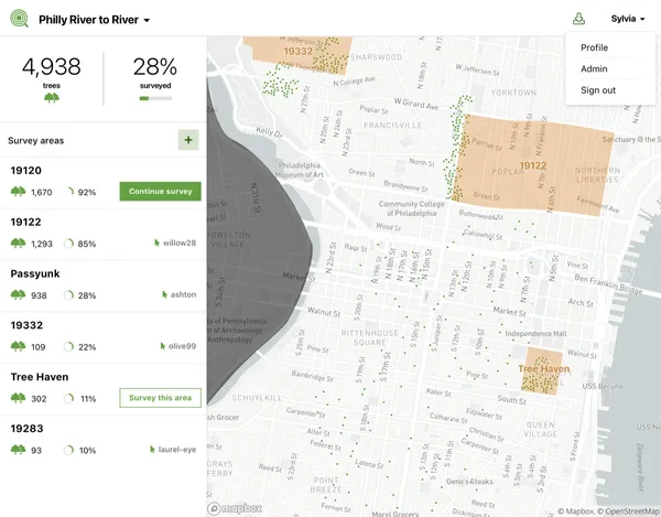
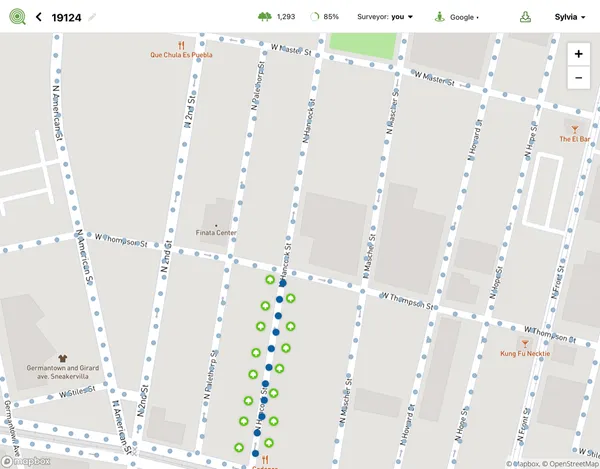
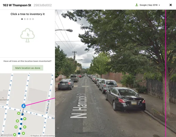
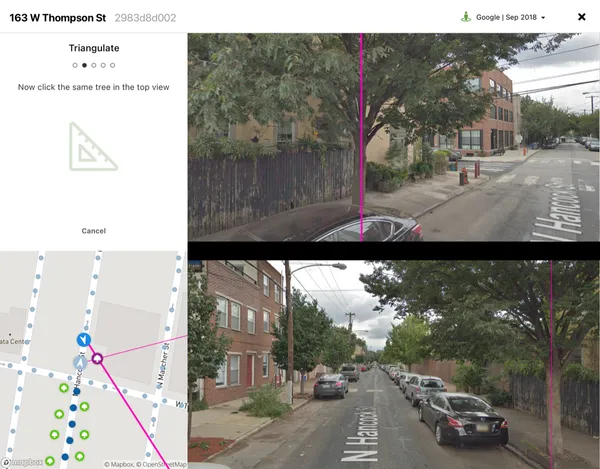
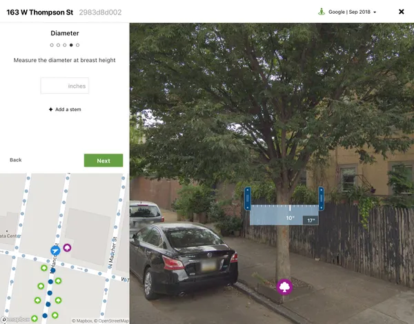
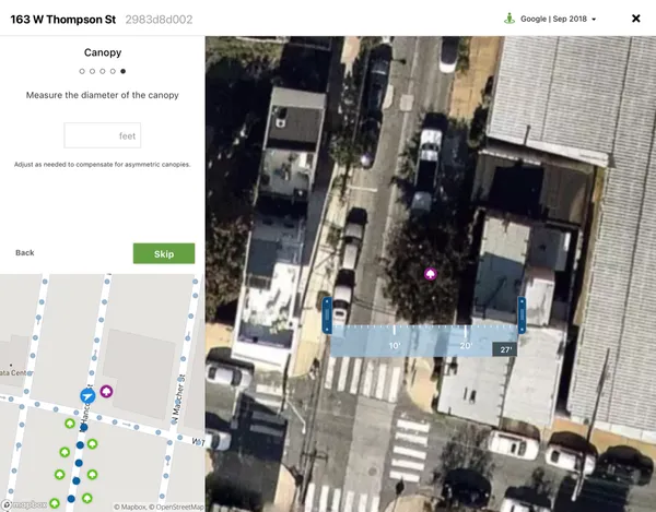
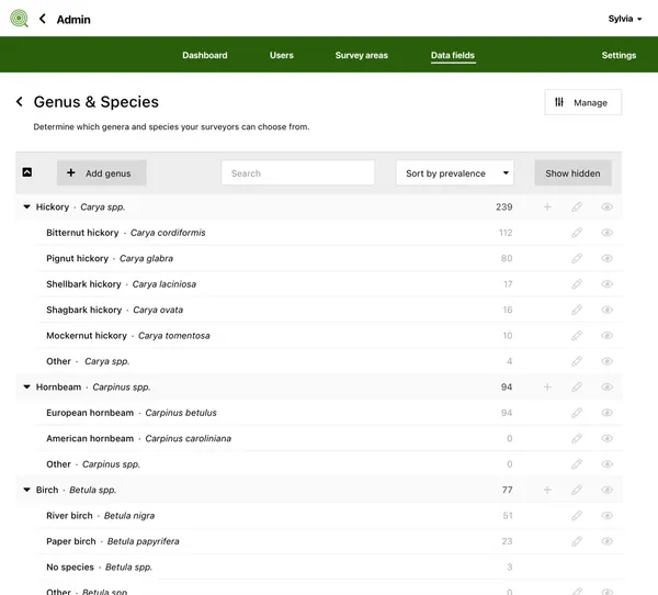
Customers divide their geography into arbitrary survey areas, each assigned to an individual surveyor The survey area map indicates known trees and surveyed/unsurveyed locations Surveying a location begins by clicking a tree in the panorama viewport Clicking the same tree in an adjacent panorama viewport then triangulates its location The surveyor then fills in genus and other observable characteristics Onscreen calipers make measuring diameter a breeze And canopy size as well Once a location is surveyed, its trees can still be edited Admins can customize their installation to regional patterns, including genus and species