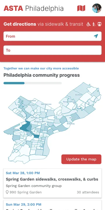
I designed and prototyped ASTA (Accessible and Sustainable
Transportation Application), a community-powered service to help people
with disabilities find accessible routes through a city. The mobile web
app was optimized for hazard-aware sidewalk and transit routing, and
reporting hazards and assets. The companion desktop site was designed
for public transparency and community-organized reporting events. The
work was funded by a HHS SBIR grant.
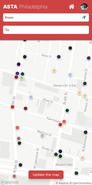
The heart of ASTA is a mobile web app for sidewalk & transit wayfinding and hazard reporting
Map view indicates known hazards
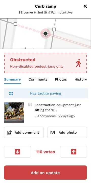
Hazard data include implications for passage and optional comments, photos, and upvotes
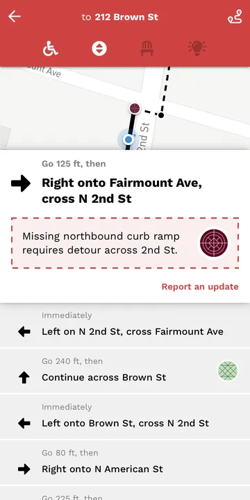
Hazard-aware directions
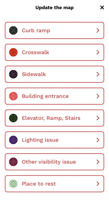
Reporting a hazard or asset begins with specifiying its type
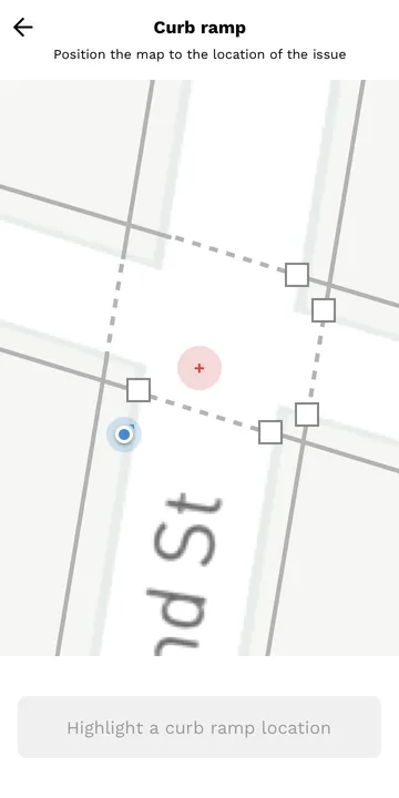
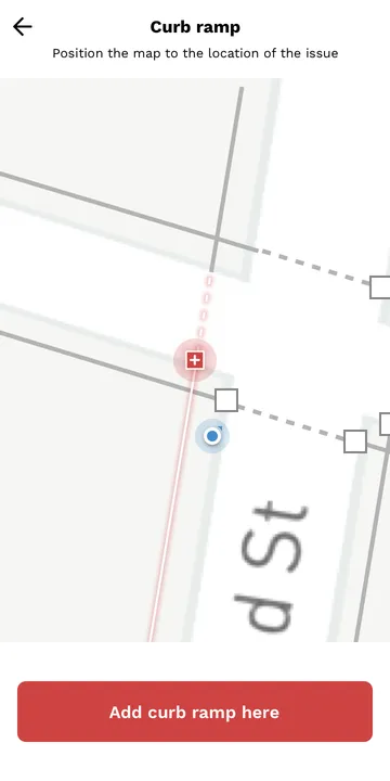
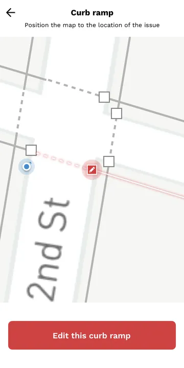
Pan the map to precisely locate the hazard or asset
Highlighting a sidewalk/crosswalk join without a curb ramp implies the goal is to add a curb ramp
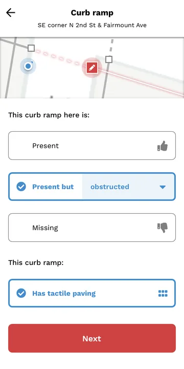
Whereas highlighting a known curb ramp implies the goal is to provide information about it
Reporting a curb ramp's status
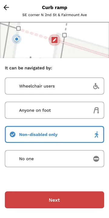
Assessing who might be able to navigate a given curb ramp
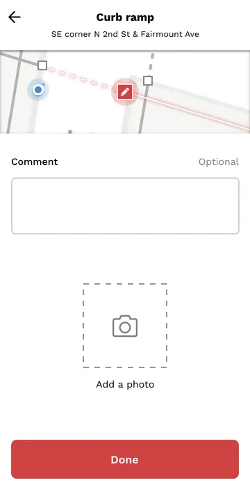
Comments & photos help others understand whether a hazard or asset is navigable for them